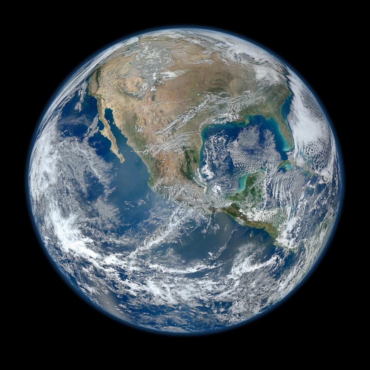
A stunning image of Earth was captured using photographs taken by the Visible/Infrared Imager Radiometer Suite (VIIRS) instrument on the Suomi NPP satellite. This image showcases many distinct features of North America and the Western Hemisphere. The composite image was created from data collected during four orbits of the satellite earlier in January 2012 and then digitally projected onto a globe.
As we celebrate Earth Day, let’s all take a moment to appreciate the beauty and wonder of our planet. One way to do this is by joining us in sharing a #GlobalSelfie. This powerful tool collects visible and infrared imagery, providing global observations of Earth’s land, atmosphere, cryosphere, and ocean. It builds upon the observational records of similar instruments on previously launched satellites such as NASA’s Moderate Resolution Imaging Spectroradiometer (MODIS) and NOAA’s Advanced Very High Resolution Radiometer (AVHRR).